|
Cheshire County DX ARC |
|
Cheshire County DX ARC |
![]()
Surry New Hampshire
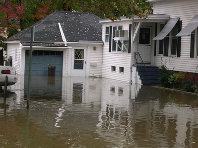
The 2005 Flood
(Which also includes Alstead and numerous other towns in Cheshire County)
Here we go again
On the evening of Friday, October 7, 2005, the rains came, and came, and
came some more! Over the course of
the next couple days, rain was measured in excess of 10 inches in some areas of
Cheshire County. Yes, thats
right INCHES! It rained very hard
all of Saturday, Saturday night and into Sunday morning, which resulted in lots
more road closures.
Fortunately,
for the Town of Surry, we only lost 3 roads this time.
We lost the small section of Pond Rd which connects RT12A to Village Rd,
no big deal with that, as it didnt hinder traffic flow much.
We lost the lower section of the Dort Rd, on the Federal Land, so that
didnt have ANY effect on traffic, but we did loose 2 substantial sections of
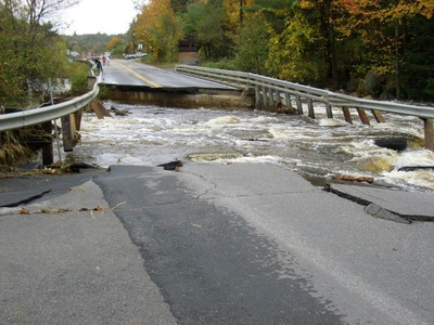
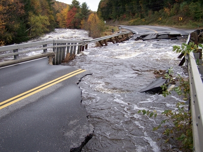
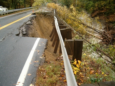
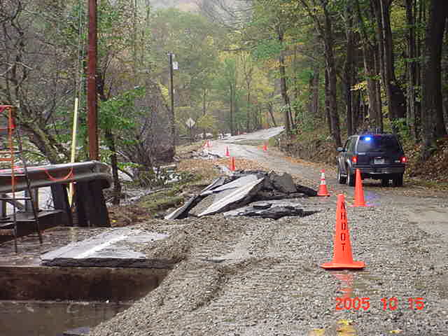
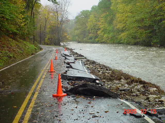
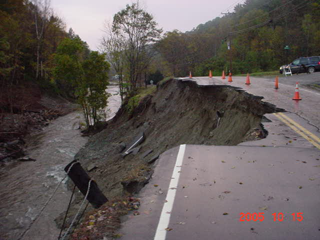
RT12A which obviously did have an adverse effect on traffic.
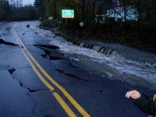
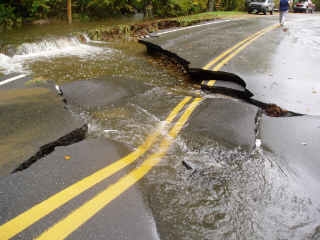
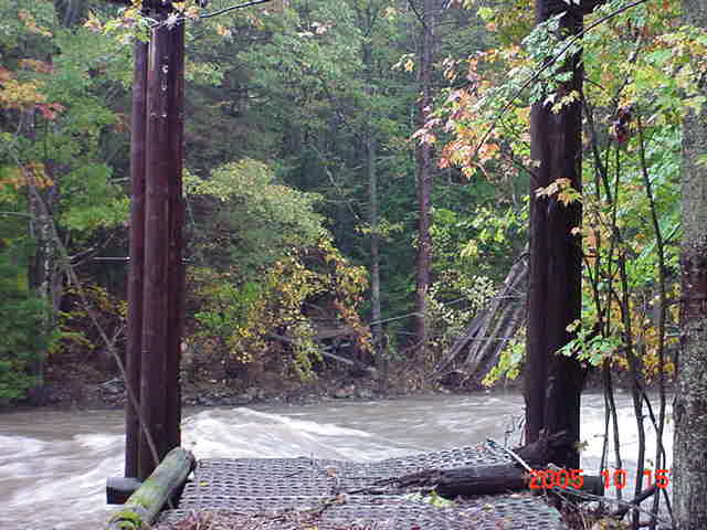
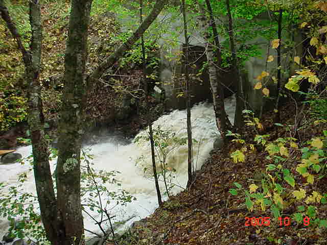
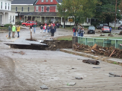
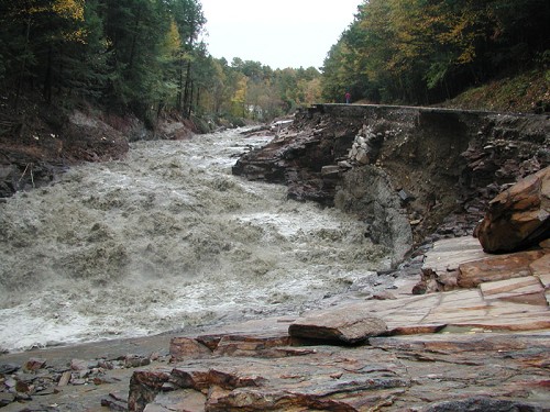
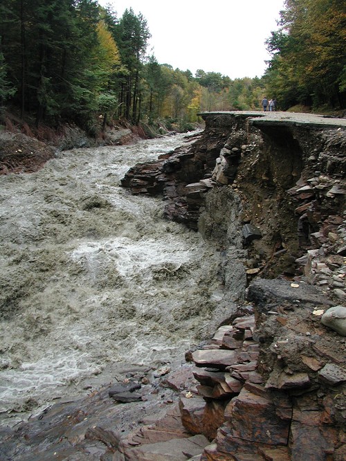
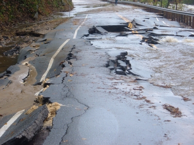
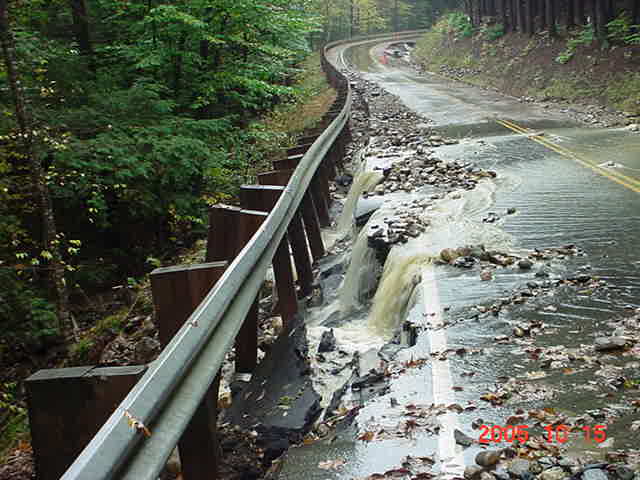
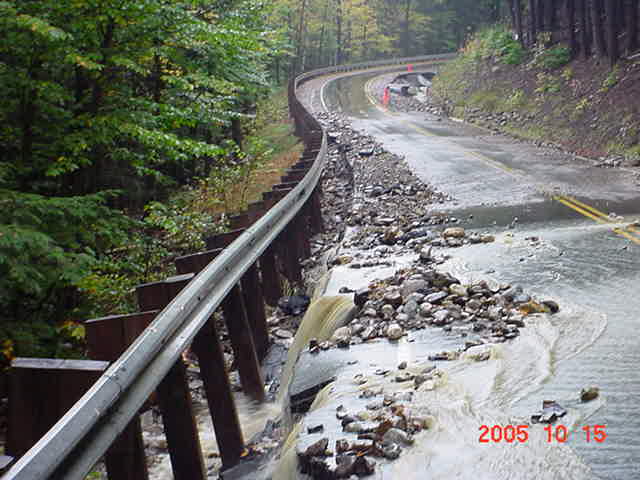
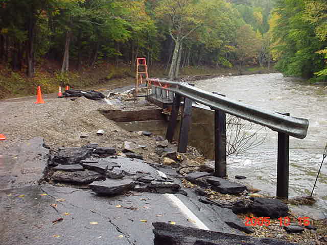
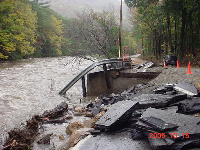
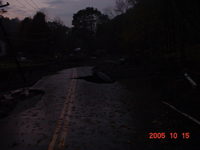
The first section of RT12A, believe it or not, was in the exact same spot that we lost back in 2003, only worse. This section was a total washout this time. About 8 feet wide and 5 to 9 feet deep. A couple of the culverts ended up in the field down stream. Further North, around the intersection of the River Rd was also lost and then another chunk over the town line into Alstead.
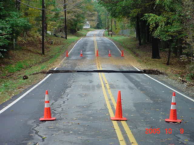
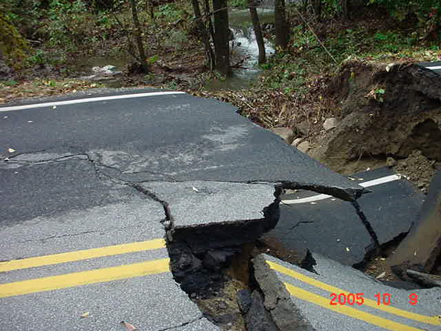
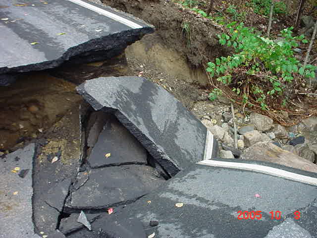
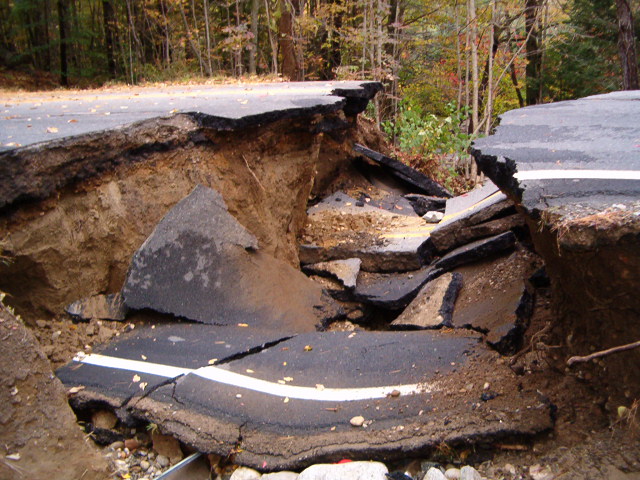
(The above photos are of the South washout along RT12A)
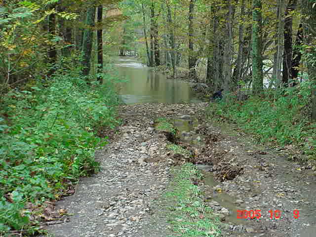
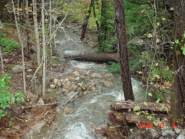
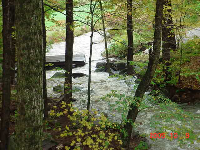
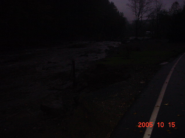
(Dort Road, this is the path the excess water from the South RT12A washout took, across the field the culvert was lying in (above) through a field and across the Dort Road parking lot.)
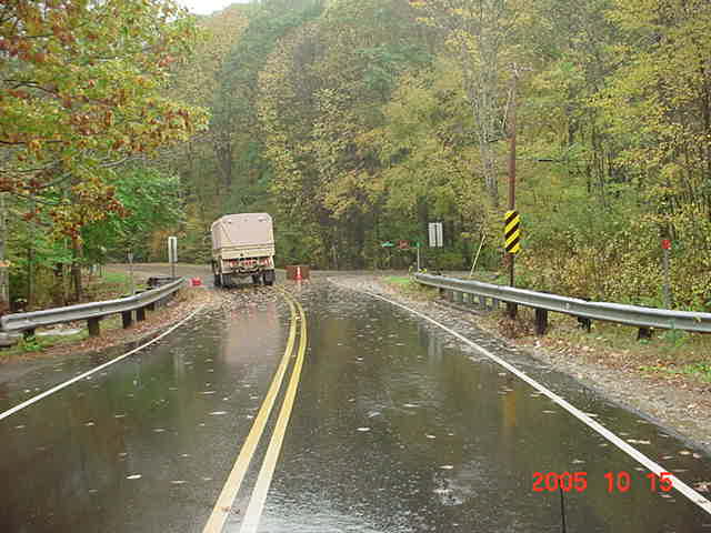
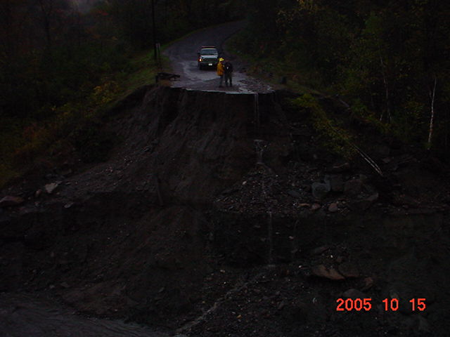
Monday, October 10, 2005 at about 5pm, I just got home from taking a quick ride up RT12A toward Alstead. The washout that I had the pleasure of babysitting most of last night is now fixed (filled back in with dirt) and is passable, but it was a short ride because I can now confirm that the road is totally washed out just beyond the intersection of the River Rd up around the corner. It does seem that should we need to get there in the cruiser, we may be able to do it by going across a lawn, along the edge of the washout, but not much, no, make that no room for error.
Intersection of River Rd on the Left.
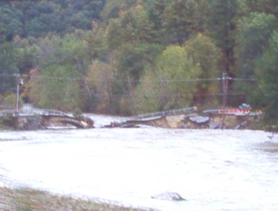
I actually
didn't get up to River Rd with my vehicle, I had to walk as DOT was still
repairing a washed out section of the Northbound lane by the old steel
suspension bridge - which is now completely gone.... well, lets say it doesn't
cross the river anymore, it now resides pretty much in it's entirety, lying
along the shore of the East side of the river in a twisted mass of steel and
cables.
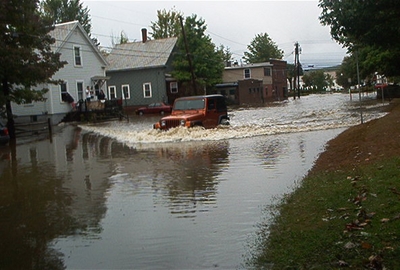
Now speaking of Alstead While I was on duty, having gotten called out about 6am on Sunday the 10th, to relieve the overnight guys, radio traffic was very interesting and busy. Alstead was watching the dam near Cooper Hill and had declared a Code Red which isnt something you ever want to hear, especially if you happen to either be or live downstream! Sometime a little after 7am, I just checked my caller history of my cell phone, 7:24am to be exact, I heard that this dam had let go and there was a huge insurgence of water heading down. Now for those that dont know, Surry is South of Alstead, and considerably down hill as well. I got onto the fire channel and asked fire dispatch (415) to find out if this wall of water was going to have any impact on us. (I'm still getting conflicting information as to weather this was the result of water going over the top of the Lake Warren Dam, or a banked culvert thing by Cooper Hill that let go... Okay, here's the deal, the dam at Lake Warren overflowed and was backed up at a culvert at Cooper Hill, when that finally eroded away, that's when the wall of water headed toward town...)
Within
a few seconds I found out that it was heading directly toward the Connecticut
River. That was a relief to me on
one hand because Surry wasnt going to get hit with it, but I also work for
Walpole PD now, and knew that we had some Officers stationed along RT123 in
North Walpole because the Cold River Bridge was already out, and the Cold River
was the route it was heading for. About
a minute later, I heard the Alstead fire chief screaming into his radio to tell
everybody downstream along the Cold River to Get the Hell Out!!!!! It aint
going to be good.
With communications being as poor as they are in this County, especially on the police side, I was afraid that the usual several minutes delay of getting messages from the fire side of things over to the police side of things was going to endanger our guys over there, so I began group calling all the units over there on the cell phone warning them of the higher water that was heading their way. They did get the word, as everyone got out of there safely!
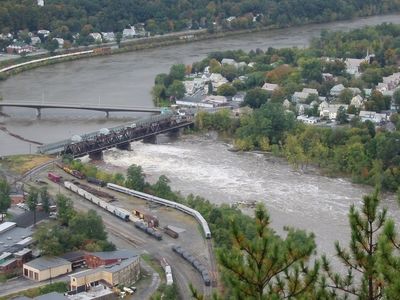
Connecticut River, Bellows Falls, VT on left - No Walpole, NH on right
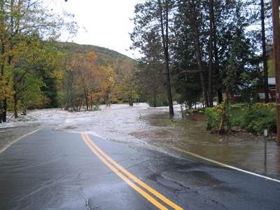
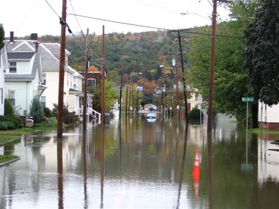
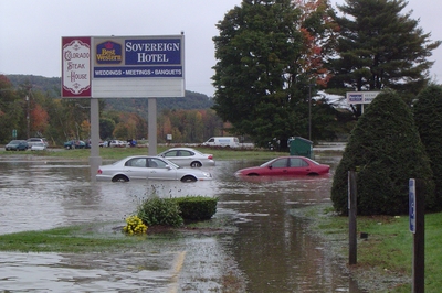
As of about 7pm on Sunday, October 9, 2005, the following roads have been closed.
|
Route
9 in Sullivan between | |
|
Route 31 between Route 10 and Route 9 | |
|
Route 123 in Alstead from the village to Mill Hollow (5 miles) | |
|
Route
119 in Hinsdale between Route 63 north and | |
|
Route
63 north in | |
|
Route
123, Alstead-Walpole (Drewsville) from west intersection of Route 12A to
Route 12 | |
|
Route 123A in Acworth near Marlow town line | |
|
Route
12A in Surry-Alstead from | |
|
Route
123 bridge over | |
|
County
Road in | |
|
Route 123 in Marlow-Stoddard from Route 10 to Route 9 | |
|
Route
10 in | |
|
Route
10 in Gilsum-Marlow from | |
|
Shaws
|
Bridges with critical problems:
|
Route
123 in North Walpole over the | |
|
Routes
119 in | |
|
Route
9 in Sullivan over Otter Brook | |
|
Route
123 in | |
|
Route
123 in Alstead over the |
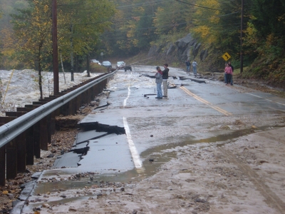
Fortunately, RT12 in Westmoreland hung together this time, so we still had a northern route out of the Keene area.
Downstream of Mill Pond, along Surry Dam Road
Pond Rd in Surry
Village Rd Pavilion at the Rec Area
Alstead Main St at River St
Alstead RT123 just North of RT12A intersection from Surry
Alstead, Intersection of RT12A from Surry and RT123
Alstead, Intersection of RT12A from Surry and RT123
Alstead RT123
Alstead RT123
River Rd between Surry and Gilsum
RT10, just North of Gilsum Village
RT10, just North of Gilsum Village
RT9 East from Roxbury, just before Sullivan Store
RT9 East in Sullivan looking toward Roxbury
RT63, Hinsdale
Adams St, Keene
Adams St, Keene looking toward Marlboro St
Water St, Keene near rear of 176 Main
Winchester St, Keene
Lower Winchester St, Keene, very close to Matthews Rd
I don't think Surry will be making many history books this time, but the surrounding towns very well may.
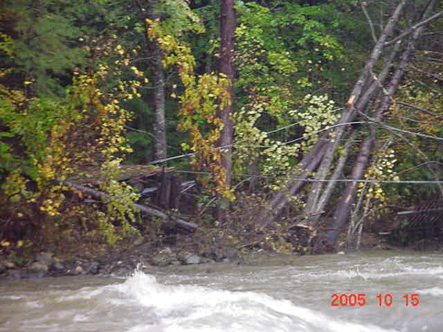
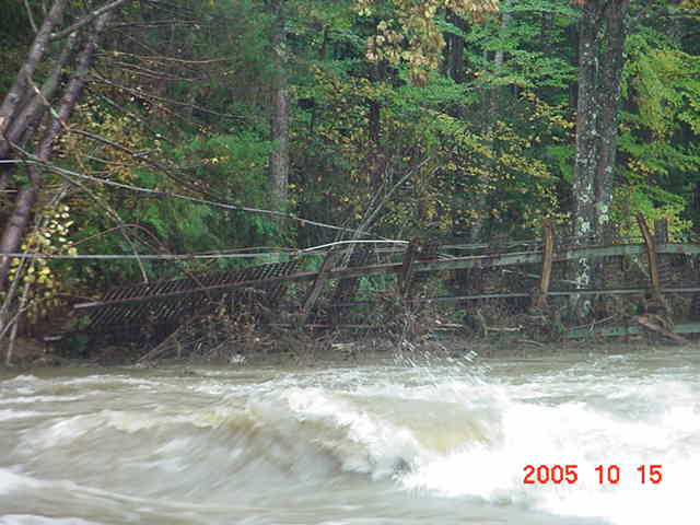
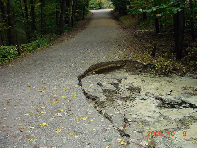
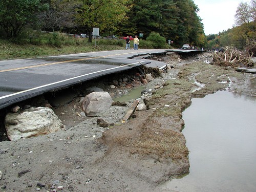
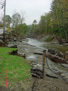
Saturday, October 15, I decided to ride around Surry in my own vehicle during the afternoon to check on how some of the roads were coming along as far as repairs. We were now into our 9th consecutive day that it has either rained all day, or portion of, and it had been raining all day, so far. I found that RT12A was passable up to the Walpole Valley Rd, but not much beyond that. Below shows why...

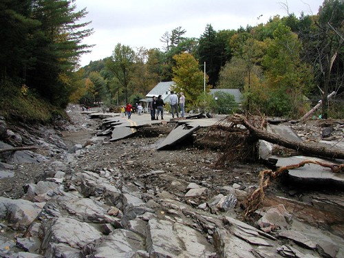
I was able to drive up to Hill Rd in Alstead a few days prior, because this section wasn't too bad then, but it sure was in rough shape now. After turning around and heading back down, you'll notice the National Guard stationed at the intersection of Walpole Valley Rd and RT12A.
I took my first trip over the River Rd toward Gilsum and found that the bridge/cement culvert prior to the Gilsum town line was out, and the road in that area is still washed out pretty bad.
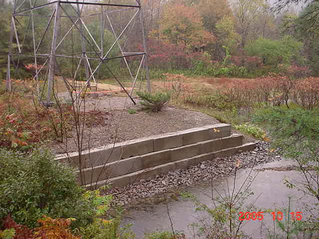
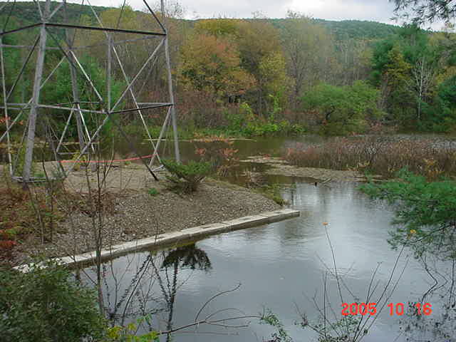
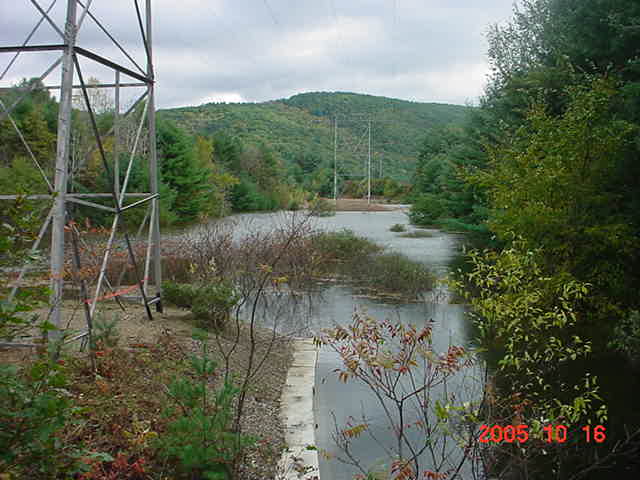
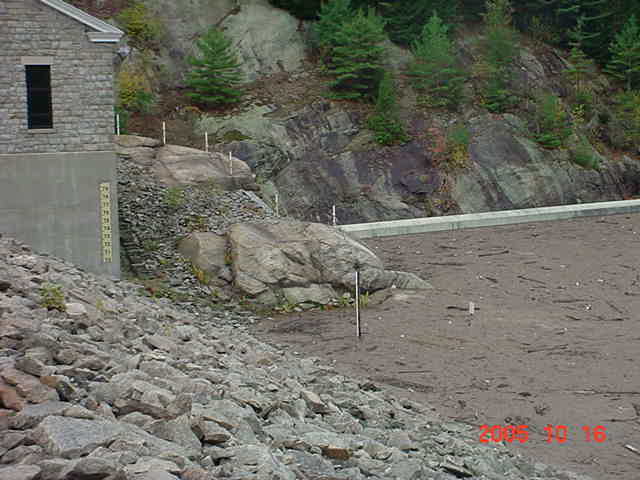
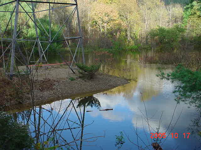
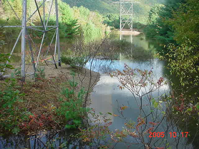
Working my way South on 12A in Surry, brings us to the High Tension lines that cross just north of the Village, near the "Smith" farm. National Grid had just finished repairing the footings of this tower with blocks and crushed stone because of the erosion the brook caused to the legs.
Just south of the power lines, shows a shot toward the back side of the Village.
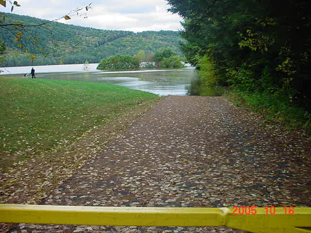
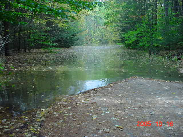
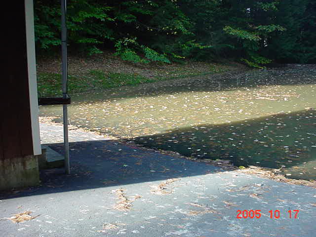
Village Rd South Gate looking at where the roof of the upper pavilion was sticking out several days ago... (See the picture toward the beginning)
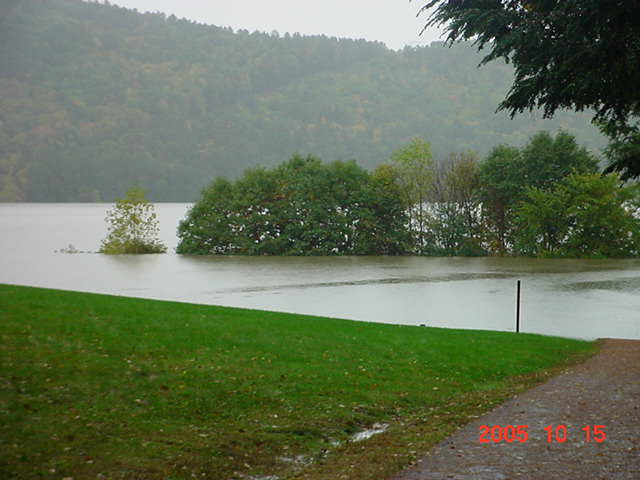
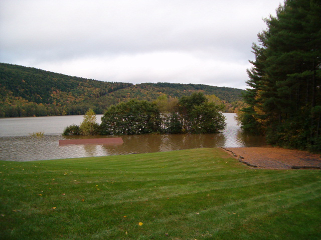
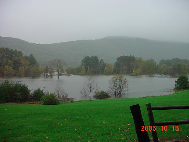
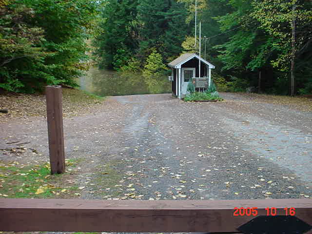
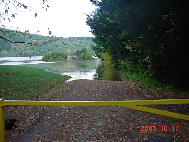
Entrance to Surry Lake, water is almost up to the fee booth.
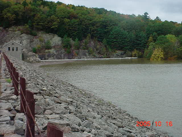
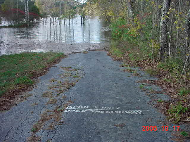
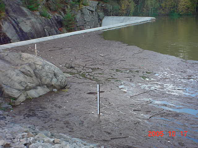
Now looking at the water level of the spillway at the dam itself. We were beginning to seriously pay attention to this now, because of the additional rains that we had already had, and the additional rains coming, we were the center of attention as everybody "downstream" from us now was watching to see what happens here. Keene did several voluntary evacuations of the lower lying areas, including 6 dorms at Keene State College. The last time water was this high at the dam was back in 1987, when it actually did go over the top. I had been receiving phone calls all week long from the Army Corps of Engineers, updating me as to water levels, outputs, intakes, and if we get this amount of rain, if we get that amount, etc... I learned more about this place over the past week, I could probably almost run it by now.. Not really, but the dam did exactly what it was designed to do - control flooding! The crew at the ACOE did a FANTASTIC job!! I also was monitoring the levels via the web, obtaining live data every few hours. These are a couple of the graphs that we were watching very closely. Pool Level and Data
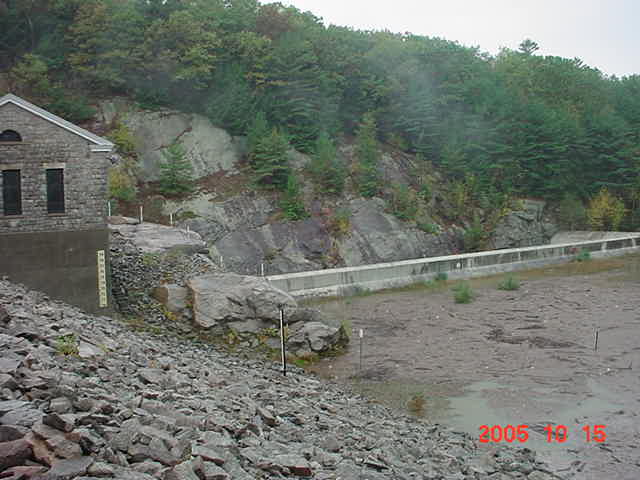
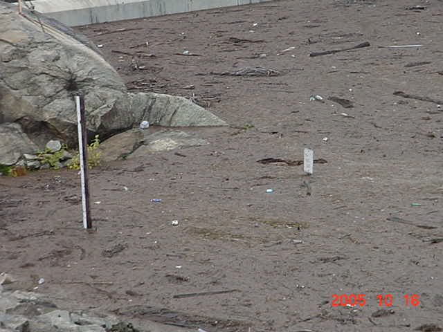
Notice that "street" sign in the water there? Make note of the water level.
Shortly after I got back on Saturday, October 15, I was called in to work for Walpole, but not to patrol Walpole, I was re-assigned for the night to cover East Alstead, which happens to be the side of town where it all began... A lot of the surrounding towns have been assisting Alstead PD because quite frankly, you can't easily get from one side to the other. When I went on duty, I also grabbed the camera, because I figured I'd be able to get a few first hand pictures of the "area in question" before it got too dark. The first image below, is where all the troubles for Alstead started. That's my Walpole cruiser parked at the intersection of Cobb Hill Rd at RT123. Directly across 123 is/was the end of Cooper Hill Rd. Below that is Cooper Hill, (Sorry for being so dark, it shows up much better on flat screens), and below that, where 123 just ends.
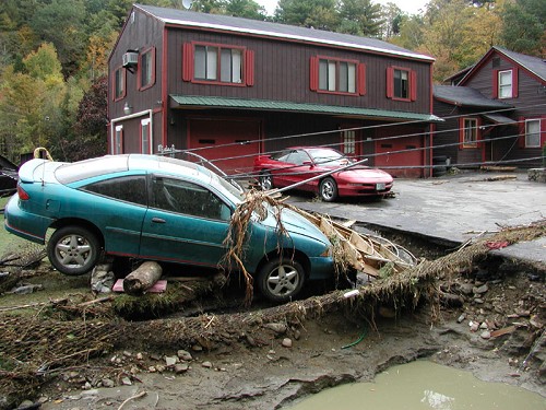
The below picture is of the first house the water hit. Or should I say, where the house was. If you are able to pick it out, that vertical thing standing all by itself on the left side, is actually the water well casing. That's the only indication there was even a house there. No house, no foundation, no driveway, no lawn, nothing!
I've been doing this line of work longer than I haven't, and I have never seen such devastation so close to home. Absolutely incredible.
Let's get back to Surry....
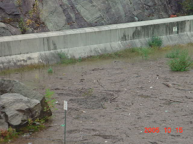
Sunday, October 16, I took another little trip around Surry. The below pictures have already been described above, and most are taken from just about the same location, less then 24 hours later. What a difference a day makes - oh, and a few more inches of rain!!
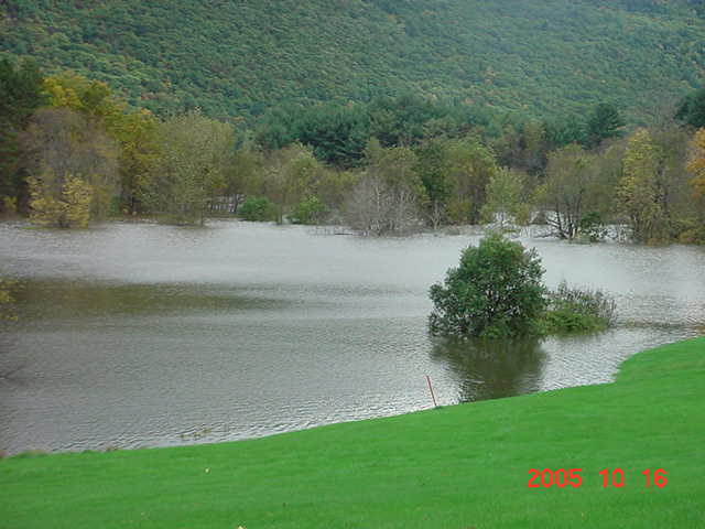
These two look familiar - although a lot bigger than when they first appeared in the pic from the 2003 floods... This picture is the South end of the Village Rd, usually about a 60 foot drop off to the water, today, it's about 2 feet.
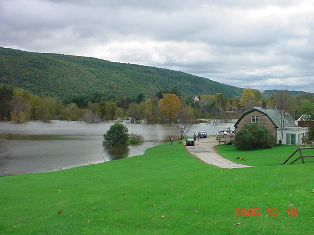
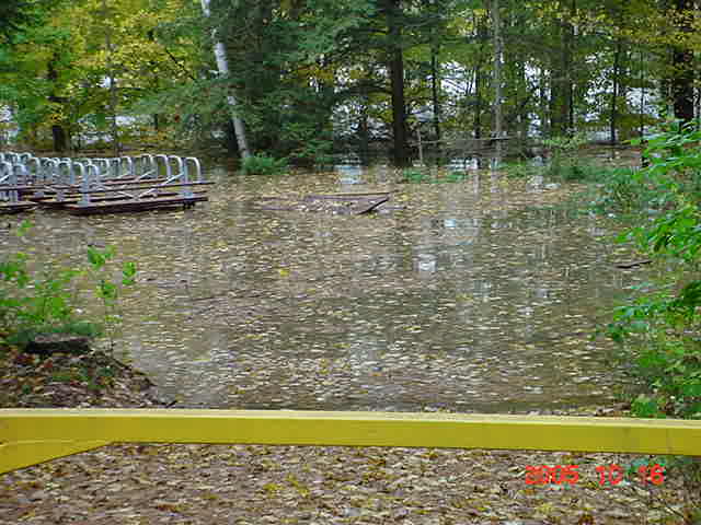
There's that missing pavilion again.
The road to the Surry Campground. And one of the Fee Booth attendant sites along the road.
Remember that "street" sign? There it is... or what's left of it. But wait....
Can't even see the blocks today...
North Village Rd gate, showing water level in comparison to the markings for the 1987 spill.
Pavilion is still missing at the South gate...
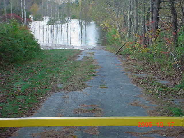
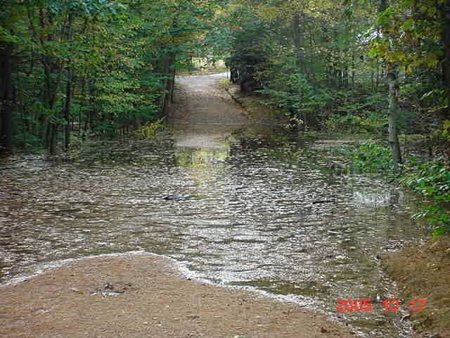
Pond Rd between Village Rd and RT12A, completely flooded.
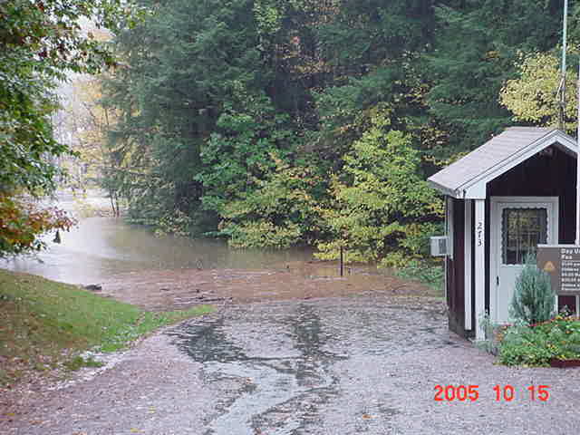
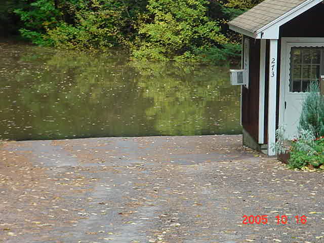
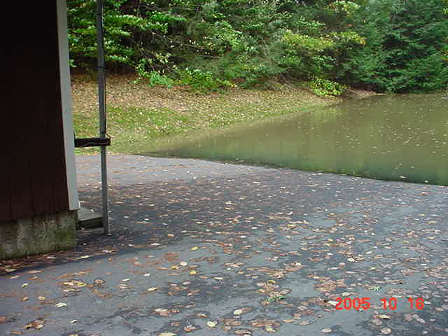
Behind the Fee Booth, entrance to the lake.
Remember that "street" sign? There it is......
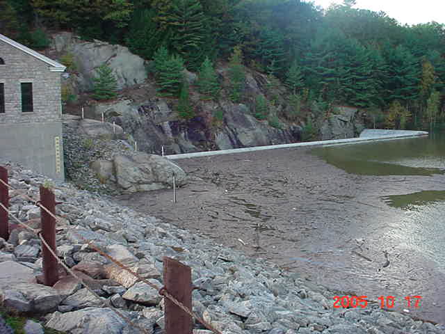
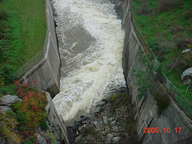
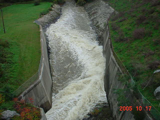
And finally the discharge side of the dam.
Lt Joel Huntley - Surry Police Dept
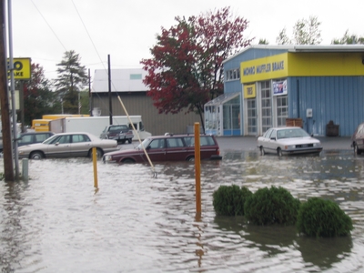
Images from the flooding back in 2003 - Surry Floods
The fine print: Several of the pictures on this page were not taken by me. I also have no idea who to credit as some were included in emails that had been circulating around.
![]()
|
|
|
|
|
|
|
|
Home | Info
| Newsletter | Calendar
| Members | Scrapbook
| Links | Site News | 146.805
| For Sale
Questions or suggestions about this WebSite should go to the WebMaster

View My Guestbook
Sign My Guestbook
|
|
![]() Thursday, October 20, 2005
Thursday, October 20, 2005