|
Cheshire County DX ARC |
|
Cheshire County DX ARC |
![]()
Surry New Hampshire
The "Floods" of 2003
During the Month of August, 2003, specifically Wednesday, August 6 and then again Sunday, August 10, the Town of Surry experienced a couple floods. And as I write this webpage, on Monday, August 11 at about 6:20pm, it's raining yet again...
The flooding that occurred on Sunday made what happened the Wednesday before look like a cake walk. Wednesday's rainfall amounted to something in the order of 2.5 inches of water an hour for over two solid hours! The run-off from the hills and mountains was incredible to say the least! We had never experienced anything like it - at least not recently. Sunday's rainfall exceeded that.
On Wednesday, RT12 in Westmoreland had washed out forcing it's complete closure. (Keene, less than 5 miles away, didn't have a drop of rain. Only cloudy skies to the North.) This event alone naturally had a significant impact on the Old Walpole Rd, which pretty much parallels RT12, except it's on higher ground. As State DOT crews worked almost around the clock to get RT12 re-opened, the rains came again on Sunday - and with a vengeance. As I listened on the police radio to the DOT channel, and I started hearing them advising the crews to get all the equipment they could to higher ground ASAP, I was pretty sure "this wasn't a good thing". My suspicions were correct as the torrential rains descended on Surry once again. Oh, and the RT12 repairs in Westmoreland? All gone, and then some... They had more damage than from the rains on Wednesday.
Below are a few pictures I managed to take while "on patrol" in Surry on Wednesday.
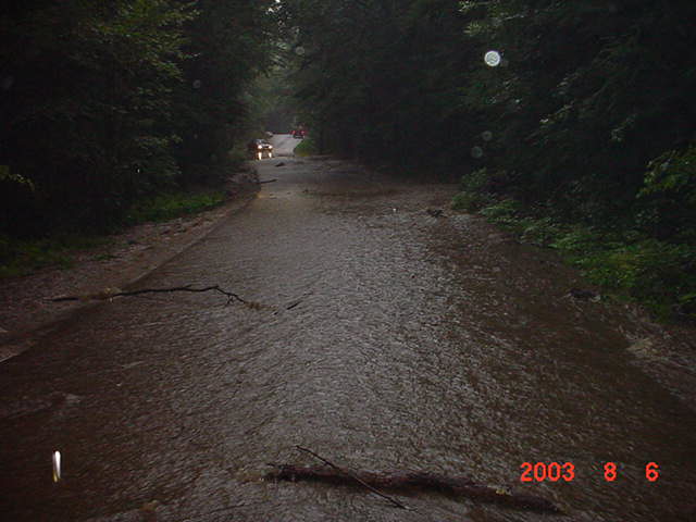
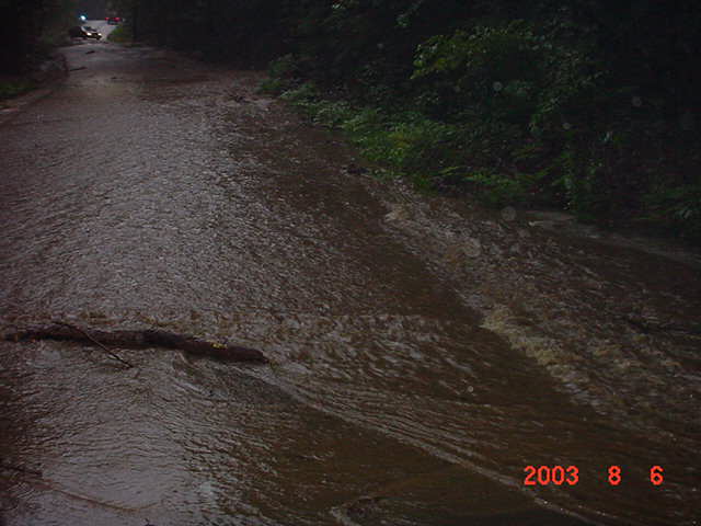
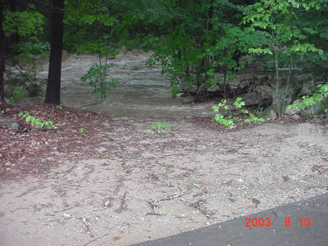
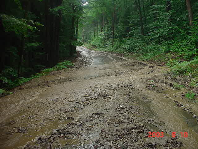
Pond Rd just above the Highway Garage.
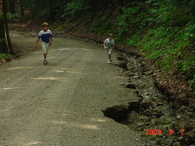
Upper end of the Joslin Rd, just after the bridge the day after.
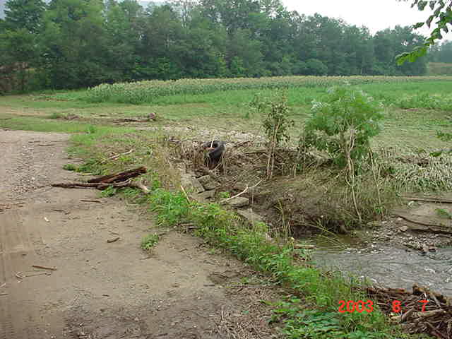
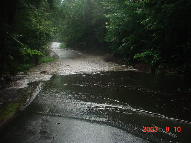
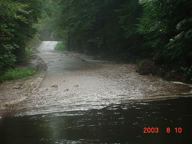
Merriam Brook, the culvert on the access road to the sand pits...Lower Joslin Rd, Thursday - the day after the first flood.
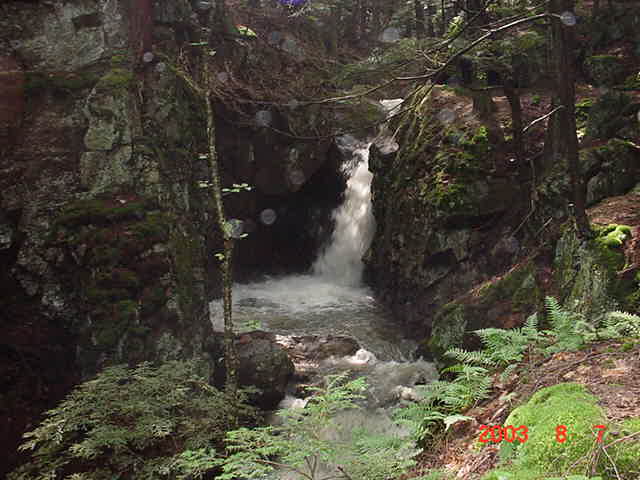
40 Foot Falls on Thursday.
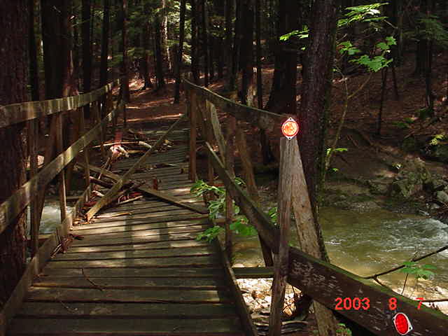
Snow Machine bridge just below 40 Foot Falls on Thursday. Becky watched it on Wednesday as the water was going over the deck.
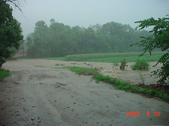
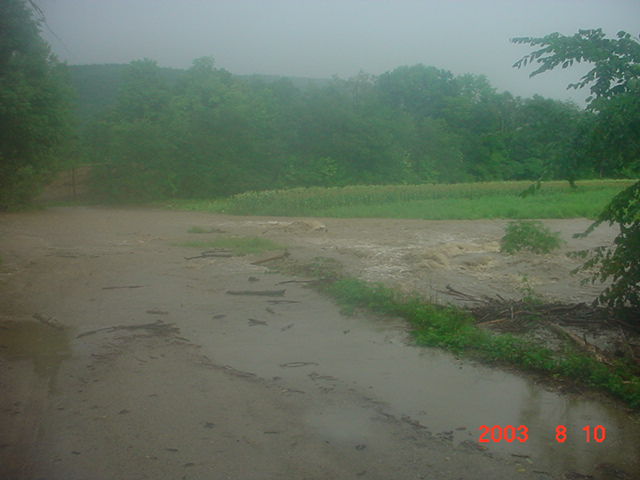
Now Sunday, was a lot worse... It began just after noon for me. The Sheriff's Dept called on the phone and asked me to back-up Walpole with a situation they had going on. About 2 hours later, I was leaving the PD in North Walpole, and the sky had opened up. Very similar to the rain on Wednesday back in Surry. By the time I had driven back to Walpole Village, the sun was still shining, however, as I got closer to Surry along the County Rd, I was back into very, very heavy rain again. I was already noticing that the ditches were beginning to reach their maximum limits. Concerned that all the road work that Surry Highway had already done on the upper end of the Joslin Rd and along the Old Walpole Rd was in jeopardy, I began patrolling around - just in case. It wasn't long and we were right back to where we were on Wednesday - only worse!
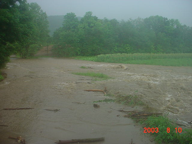
Merriam Brook - Lower Joslin Rd as raging flood waters "remove" the access road into the sand pits.
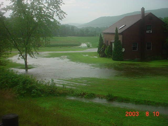
House rapidly becoming an island.
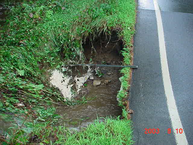
Merriam Brook as seen from Joslin Rd.
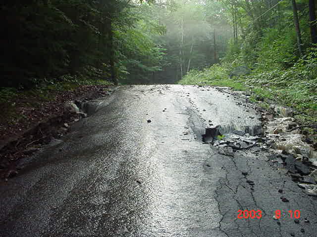
The paved end of Joslin Rd. - or at least it "was"...
Remember what the Pond Rd looked like on Wednesday?
Meanwhile, as all this is taking place I decide to take a cruise up RT12A and head toward the Alstead Town Line because I was wondering what kind of a mess Webster Rd was putting across 12A.... Problem was, I never got there. I found quite a washout alongside the Northbound lane just beyond the Dort Rd, so I thought I'd take a look to see how badly that had undermined. Well, the Northbound lane wasn't a problem, it was what I found across the road next to the Southbound lane.
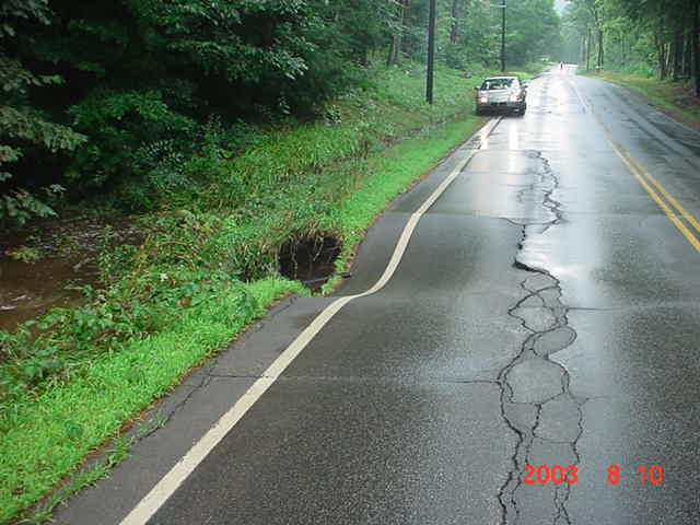
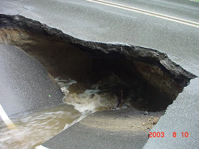
Now when I first arrived, the Southbound lane was still intact and level. The water was just to the edge of the pavement, but I could tell that some undermining had occurred. I made the decision to close off RT12A to through traffic. I just couldn't risk somebody ending up in who knows what... A good choice if I say so myself, as I stood there and watched the pavement slowly sink and then collapse. The undermining (which doesn't show very well above) extended beyond the yellow lines into the Northbound lane. We now had a SERIOUS traffic problem, and here's why... RT12 in Westmoreland was washed out - completely. RT63, which "had" been the detour route for RT12 had washed out. The Old Walpole Rd had in excess of 2-3 feet - yes, feet of water and debris flowing quite freely over that, Joslin Rd was washed out, Pond Rd was washed out. River Rd over to Gilsum had about a foot of water going over it. RT10 North was down to one lane, Walpole Valley Rd was flooded and there was also some flooding along the County Rd in Walpole. Eventually, the tide subsided and road crews were able to clear debris from roads that still had pavement left, although somewhat narrower because of the ditch erosion. RT12A remained closed most of the night, but State DOT crews got that filled in by morning. Who knows about RT12 and how long that will take - again.
This summer will probably be one for the history books.
Lt Joel Huntley - Surry Police Dept
Movie Clip 1 of Pond Rd Movie Clip 2 of Pond Rd Movie Clip 3 of Pond Rd
** Flooding in Cheshire County, October 2005 **
![]()
|
|
|
|
|
|
|
|
Home | Info
| Newsletter | Calendar
| Members | Scrapbook
| Links | Site News | 146.805
| For Sale
Questions or suggestions about this WebSite should go to the WebMaster

View My Guestbook
Sign My Guestbook
|
|
![]() Tuesday, October 11, 2005
Tuesday, October 11, 2005